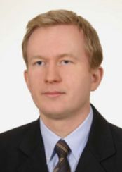
dr inż. Jarosław Wajs
Email: jaroslaw.wajs@pwr.edu.pl
Jednostka: Wydział Geoinżynierii, Górnictwa i Geologii » Katedra Geodezji i Geoinformatyki
 ul. Na Grobli 15, Wrocław
bud. L-1 (Geocentrum), pok. 364
tel. 71 320 6823
Konsultacje
- poniedziałek 9.00 -11.00, sala 364
- środa 9.00 - 11.00, sala 364
Zainteresowania naukowe
- fotogrametria; teledetekcja; miernictwo górnicze; bezzałogowe systemy latające, LiDAR.
Najważniejsze publikacje z ostatnich lat
2025
- Kujawa, P., Wajs, J., Kasza, D., & Remondino, F. (2025). Monitoring a flooded open-cast mine with combining remote sensing techniques. The International Archives of the Photogrammetry, Remote Sensing and Spatial Information Sciences, 48, 155-161
- Blachowski, J., Wajs, J., & Kawałko, K. (2025). A Differential Bathymetric Dataset of Anthropogenic Postmining Lake in the Glaciotectonic Muskau Arch Geopark, Poland. Geoscience Data Journal, 12(3), e70013.
- Kujawa, P., Wajs, J., & Pleśniak, K. (2025). The approach to UAV image acquisition and processing for very shallow water mapping. International Journal of Applied Earth Observation and Geoinformation, 141, 104604.
2024
- Blachowski, J., Wajs, J., Walerysiak, N., & Becker, M. (2024). Monitoring of Post-Mining Subsidence using Airborne and Terrestrial Laser Scanning Approach. Archives of Mining Sciences, 69(3), 431.
- Siejek, M., Kasza, D., & Wajs, J. (2024). Methodology of spatial data acquisition and development of high-definition map for autonomous vehicles–case study from Wrocław, Poland. Civil and Environmental Engineering Reports, 34(1).
2023
- Blachowski, J., Becker, M., Kujawa, P., Koźma, J., Warchala, E., Dynowski, A.,Wajs J & Buczyńska, A. (2023). Transformation processes in lignite post-mining landscape-erosion of anthropogenic formations in the former “Przyjazn Narodow–Szyb Babina” mine (Poland). Zeitschrift der Deutschen Gesellschaft für Geowissenschaften, 565-580.
- Trybała, P., Kasza, D., Wajs, J., & Remondino, F. (2023). Comparison of low-cost handheld lidar-based slam systems for mapping underground tunnels. The International Archives of the Photogrammetry, Remote Sensing and Spatial Information Sciences, 48, 517-524.
- Wajs, J., & Kasza, D. (2023). A multi-purpose USV prototype for photogrammetry applications–Case study of a 3D model of the Grunwaldzki Bridge (Wrocław, Poland). The International Archives of the Photogrammetry, Remote Sensing and Spatial Information Sciences, 48, 199-204.
2021
- Wajs, J., Trybała, P., Górniak-Zimroz, J., Krupa-Kurzynowska, J., & Kasza, D. (2021). Modern Solution for Fast and Accurate Inventorization of Open-Pit Mines by the Active Remote Sensing Technique—Case Study of Mikoszów Granite Mine (Lower Silesia, SW Poland). Energies, 14(20), 6853.
- Wajs, J., & Kasza, D. (2021, March). Development of low-cost Unmanned Surface Vehicle system for bathymetric measurements. In IOP Conference Series: Earth and Environmental Science (Vol. 684, No. 1, p. 012033). IOP Publishing.
2020
- Wajs, J., & Milczarek, W. J. (2020, May). Detection of surface subsidence using SAR SENTINEL 1A imagery and the short baseline InSAR method-a case study of the Belchatow open pit mine, Central Poland. In EGU General Assembly Conference Abstracts (p. 11226).
2019
- Kowalski, A., Kasza, D., & Wajs, J. (2019). Structural control of mass movements on slopes formed of magmatic and metamorphic rocks: the case study of Wielisławka Mt.(SW Poland, Sudetes Mts.). Geological Quarterly, 63(3), 460-477.
2018
- Wajs, J., First experience with Remote Sensing methods and selected sensors in monitoring mining areas–a case study of the Belchatow open cast mine. In E3S Web of Conferences (Vol. 29, p. 00023). EDP Sciences.
- Wajs, J., Kasza, D., Zagożdżon, P. P., & Zagożdżon, K. D., 3D modeling of underground objects with the use of SLAM technology on the example of historical mine in Ciechanowice (Ołowiane Range, The Sudetes). In E3S Web of Conferences (Vol. 29, p. 00024). EDP Sciences.
2016
- Wajs, J., Experiment with remotely piloted aircraft systems imagery for DTM modeling. Archiwum Fotogrametrii, Kartografii i Teledetekcji, 28
- Derda, A. A., Wajs, J., Technologiczne i prawne aspekty ustalania granic nieruchomości w zakresie modernizacji ewidencji gruntów i budynków. Przegląd Geodezyjny, 88(2), 5-9.
2015
- Wajs, J., Research on surveying technology applied for DTM modeling and volume computation in open pit mines. Mining Science, 22, 75-83.
